 Catalogue PIGMA
Observation system for research
Type of resources
Available actions
Topics
Keywords
Contact for the resource
Provided by
Years
Formats
Representation types
Update frequencies
status
Scale
-
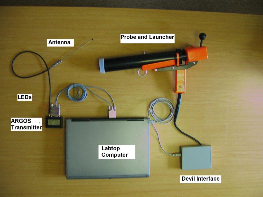
X : eXpendable; B : Bathy; T: Thermograph. Thermal profile measurement with real-time transmission
-
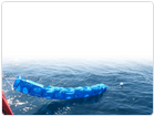
Measurements by drifting surface buoys. This system is a drifting mooring consisting of a surface buoy fastened to a floating anchor by a cable (trip line, buoy rope). It has to monitor as precisely as possible the water volume in which the floating anchor is immersed. The surface buoys are traced by Argos satellites.
-

GOSUD aims at assembling in-situ observations of the world ocean surface collected by a variety of ships and at distributing quality controlled datasets. At present time the variables considered by GOSUD are temperature and salinity. The GOSUD data are mostly collected using thermosalinographs (TSG) installed on research vessels, on commercial ships and in some cases on sailing exploration ships. GOSUD manages both near-real time (RT and NRT) data and delayed mode (DM-reprocessed) data. The GOSUD GDAC is hosted by the Coriolis data centre (France) and a back-up (permanent archived) is performed on a daily basis by NCEIS (NOAA's National Centers for Environmental Information).
-
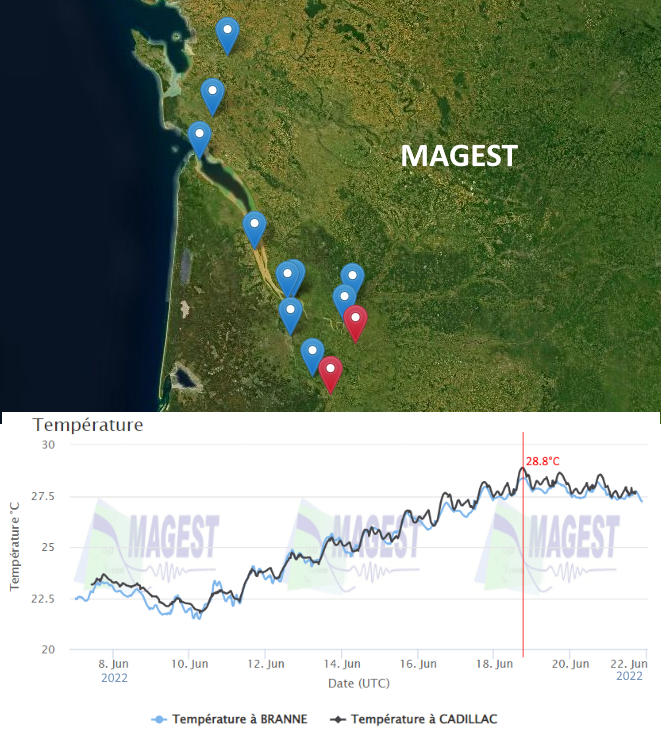
The MAGEST observation network aims to continuously monitor the physico-chemical quality of the waters of the estuaries of Northern Aquitaine. In 2023, this regional network is composed of 12 stations.
-
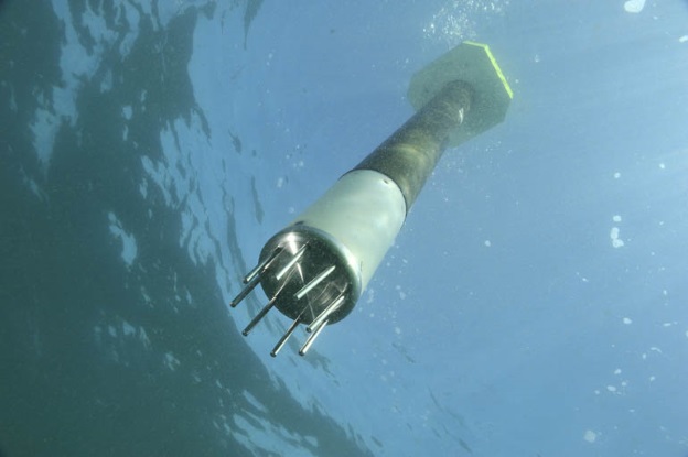
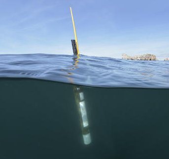
ARVOR-C is a subsurface profiling float designed to operate in coastal environments and to perform oceanographic measurements like a moored installation. Its design has been improved to reduce its drift thanks to a seabed claw and anti-drift claws, an optimized profile speed (~ 25 cm / s) and a short-period data transmission. It is able to process more than 300 profiles and real-time data transmission via Iridium satellite system.
-
Observation of surface currents by HF radars. This system of HF radars makes it possible to compile, continuously and over long periods, maps of surface marine currents, up to 100km and with a spatial resolution of 3km.
-
Description of the National Center for Archiving Swell Measurements (CANDHIS).
-
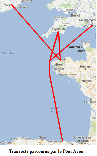
The Ferry Box onboard Brittany Ferries’ Pont Aven vessel, which was installed in collaboration with Roscoff Marine Station, was financed by the Previmer project (CPER Bretagne funding). Within the context of this project, the data acquired by the device is used in the Previmer oceanographic models. The data can be accessed with the Coriolis oceanographic data server. Six surface parameters (temperature, salinity, oxygen content, chlorophyll fluorescence, turbidity and CDOM) are regularly measured during transects through a given area. In addition to these observations, plankton (both phyto and zooplankton are counted in the same way as for the Marine Station FerryBox installed onboard the Armorique ferry.
-
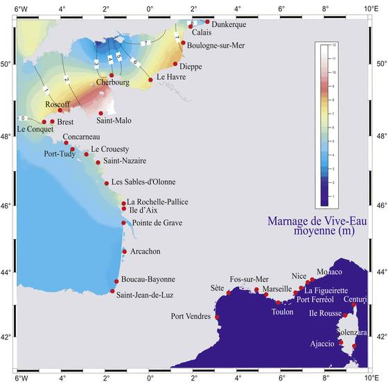
The RONIM projet is the national digital tidal network. RONIM aims to implement and maintain a modern network of tide gauges in the key ports of mainland France and French overseas territories.
-
Argo is a global array of 3,000 free-drifting profiling floats that measures the temperature and salinity of the upper 2000 m of the ocean. This allows, for the first time, continuous monitoring of the temperature, salinity, and velocity of the upper ocean, with all data being relayed and made publicly available within hours after collection. The array provides 100,000 temperature/salinity profiles and velocity measurements per year distributed over the global oceans at an average of 3-degree spacing. Some floats provide additional bio-geo parameters such as oxygen or chlorophyll. All data collected by Argo floats are publically available in near real-time via the Global Data Assembly Centers (GDACs) in Brest (France) and Monterey (California) after an automated quality control (QC), and in scientifically quality controlled form, delayed mode data, via the GDACs within six months of collection.